Utility Locator with Survey-Grade GNSS
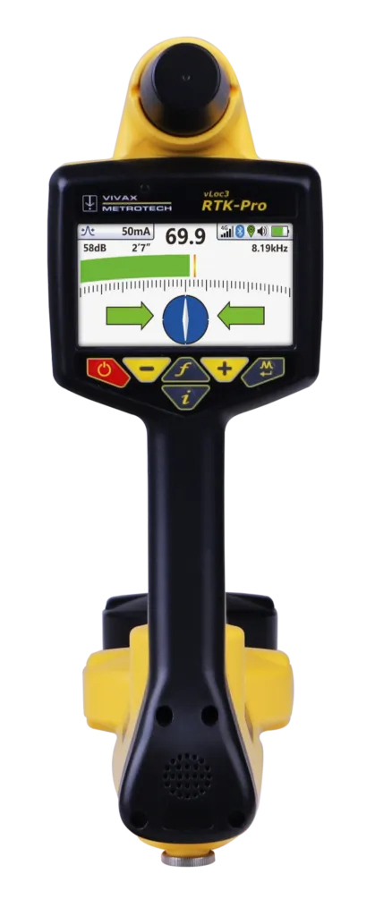
The vLoc3 RTK-Pro is the first utility locator to add survey-grade RTK GNSS accuracy. Using its internal cellular module with 4G LTE, the operator connects to an NTRIP RTK (Real-Time Kinematic) caster that provides RTCM 3 corrections — capturing both utility location data and the geographic position of the utility with survey-grade accuracy from a single instrument.
The RTK-Pro is designed for all operator levels with user-friendly, intuitive locate screens. Operators confirm the utility data with the press of a button and align the electronic spirit level to store it. All field data is sent to the cloud and retained in the receiver’s on-board storage for review and exporting to external mapping programs. The user-configurable vLoc3 series offers eight passive locate modes, fault-find mode, and configurable frequencies from 98 Hz to 200 kHz.
| Display | High-visibility 4.3″ / 10 cm color display, 480 x 272 resolution |
|---|---|
| Battery life | Lithium-ion — 16 hours continuous use |
| Operating frequencies | 98 Hz – 200 kHz configurable; power 50/60 Hz; radio 10 kHz – 22.7 kHz bandwidth |
| Locate perspectives | Classic (Peak, Null, Simultaneous Peak with arrows, Omni Peak), Vector, Plan View, Transverse Graph, Sonde |
| GNSS features | GPS/QZSS, GLONASS, Galileo, BeiDou; RTK accuracy 0.01 m + 1 ppm CEP; convergence < 10 s; cold start 24 s, reacquisition 2 s |
| NTRIP | Compatible with RTCM 3 casters; real-time station status and 2DRMS horizontal accuracy |
| Cellular | 4G with 3G fallback; LTE FDD bands 2, 4, 5, 7, 17; UMTS/HSPA 850/900/1700/1900/2100 MHz |
| Data logging & transfer | Real-time upload to VMMap server; export csv, kml, shp, txt, xls, xlsx |
| Weight | 5.5 lbs / 2.4 kg |
| Dimensions | 30″ / 76 cm (H) x 15″ / 38 cm; head 4.96″ / 12.6 cm x 3.38″ / 8.5 cm |
| Environmental | IP65 and NEMA 4 |
Interested in the vLoc3 RTK-Pro?
Request pricing, availability, or a hands-on demo from our team.